Rivers to Ramsar
This project is funded by the Australian Government’s Natural Heritage Trust under the Urban Rivers and Catchments Program, with the support of NRM South, Landcare Tasmania, Sorell Landcare, Sorell Council, Tas Water and the Tasmanian Parks and Wildlife Service (PWS).
Sorell Council is collaborating with the above organisations to roll out this important project.
Background
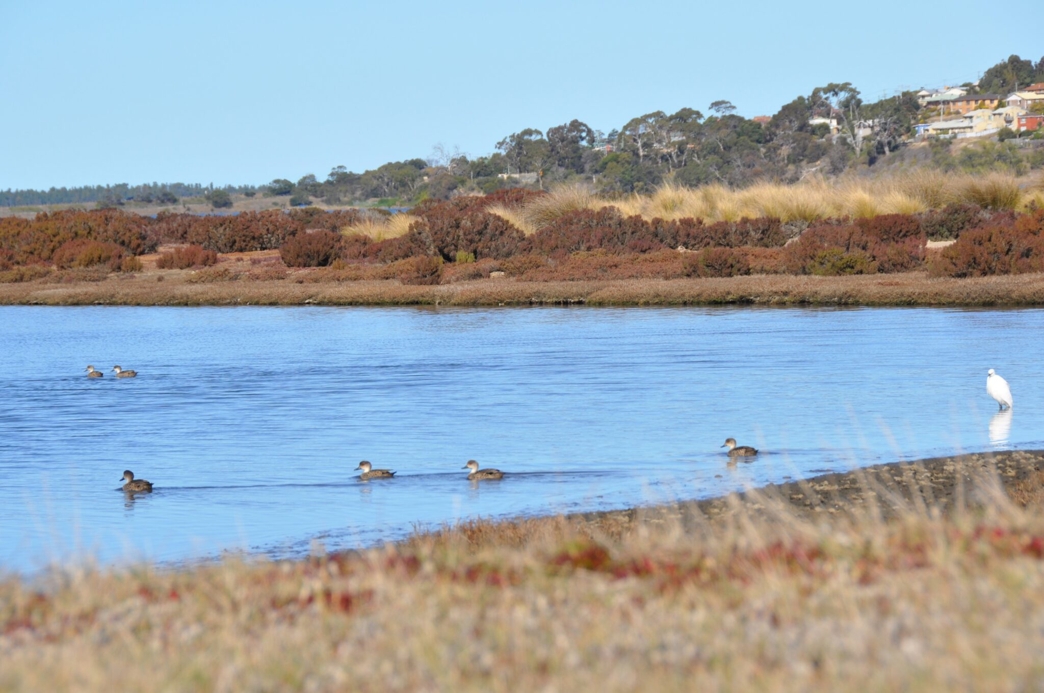
Orielton Lagoon is part of the Ramsar-listed Pitt Water-Orielton Lagoon. Ramsar wetlands are those that are representative, rare or unique wetlands, or are important for conserving biological diversity. These are included on the List of Wetlands of International Importance developed under the Ramsar convention – It is also known as the Convention on Wetlands. It is named after the city of Ramsar in Iran, where the convention was signed in 1971. For more information on Ramsar sites across Australia go to: https://www.ramsar.org/country-profile/australia
This tidal salt water lagoon is Tasmania’s only urban Ramsar site, located between Sorell and Cambridge, east of Hobart. Orielton Lagoon is classified as a Nature Reserve and is managed by the Tasmanian Parks and Wildlife Service (PWS).
Pitt Water-Orielton Lagoon supports diverse marine life, attracts migratory birds, and serves as nursery for commercially important species. It also features significant saltmarsh diversity, providing critical habitats and supporting water quality. Historically, the area was the territory of the Mumirimina people of the Oyster Bay Tribe and holds significant Aboriginal cultural value. Today, it is a hub for fishing, birdwatching, and oyster farming.
The catchment feeding the lagoon, via Frogmore Creek, Orielton Rivulet, and Sorell Rivulet, is primarily used for grazing and production, extending to the foreshore. The surrounding land is in transition from production and rural residential use to urban residential and service centre use, with substantial growth expected to persist for the next two decades.
The vegetation along the riverbanks of Frogmore Creek, Orielton Rivulet, and Sorell Rivulet acts as a buffer between adjacent landscapes, the waterway and the wetland ecosystem. However, these riparian (wetlands adjacent to rivers and streams) areas have been significantly impacted by land clearing, livestock grazing, trampling, and the spread of invasive species such as willows. Increasing urbanisation is also expected to further exacerbate these impacts.
About the project
The project will restore and remediate the riparian corridors of three waterways that inflow to the Pitt Water-Orielton Lagoon Ramsar site, reducing nutrient and sediment runoff to the site through stock exclusion, weed removal and riparian revegetation. The project will also improve critical wetland habitat for threatened migratory birds and estuarine species through the restoration of coastal saltmarsh habitat. The project activities will be undertaken on public and private land across multiple sites, including Frogmore Creek, Orielton Rivulet, Sorell Rivulet, and the Orielton Lagoon Ramsar site/nature reserve. This is a three year project, 2025-2028.
Through this project NRM are working with Landcare Tasmania, Sorell Council, private landholders and PWS to restore and remediate these riparian zones via a range of targeted actions including:
- weed control
- debris removal
- revegetation
- fencing
- eco-hydrological restoration.
The project will be led by NRM South in partnership with Landcare Tasmania (supporting Sorell Landcare) and Sorell Council and in collaboration with the Tasmanian Parks and Wildlife Service (PWS). Activities in Frogmore Creek, Orielton Rivulet and Orielton Lagoon will be managed by NRM South with support from PWS. Actions in Sorell Rivulet will be managed by Landcare Tasmania. Sorell Council is supporting NRM South and Landcare Tasmania in working with private landholders and community.
For more information on this project go to the NRM South website https://nrmsouth.org.au/project/rivers-to-ramsar/